Copyright 2020 - 2021 irantour.tours all right reserved
Designed by Behsazanhost
Neyriz Historical Sites
Neyriz
The terrain of the Neyriz region is composed mostly of ridges that are prolongations of the Zagros Mountains; the ridges run northwest-southeast and are intersected by plains. The region borders on the largest of the permanent lakes of the Fars province, Lake Bakhtegan, and Lake Tashk. The territory around Lake Bakhtegan has revealed many prehistoric sites. As a matter of fact, most of the settlements were once on the shores of Lake Bakhtegan, but because of the lake's shrinkage, they are now some distance to the southeast. The central town of the region, Neyriz, is located about 220 km east of Shiraz and is a place of great antiquity. During the Achaemenid period, Neyriz was one of the country's main armories, according to the testimony of the Elamite clay tablets found in Persepolis, and in which the name of Neyriz is first mentioned. It seems possible, however, that the original town was located southeast of the modern city, which changed its location about the Sasanid period. The city's Congregational Mosque was probably a Zoroastrian fire temple before being turned into a mosque. After such a glorious pre-Islamic history, the town lost its good fortune upon the advent of Islam. During World War I, Neyriz was occupied by the English troops led by Major Sykes. The ruins of the fort, built by the Englishmen still survive on the outskirts of the town.
Most of the local population is engaged in agriculture, the main products of which are rye, cotton, sesame, and most importantly, wheat. Poultry farming and beekeeping are also well-developed. Some of the most important stone quarries of Iran are located in the vicinity of Neyriz. The region is covered with more than 145,000 hectares of brushwood, which consists of mountain almonds, wild barberries, wild figs, and wild pistachio trees. These shrubs constitute an important wildlife habitat, and several natural protected zones have been created here to preserve the local flora and fauna.
 |
Neyriz Historical Sites
-Congregational Mosque
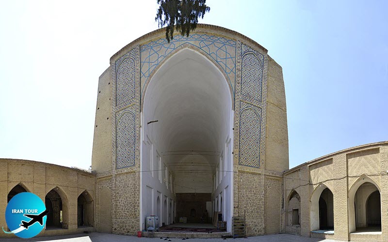
The Congregational Mosque of Neyriz is one of the most ancient Iranian mosques. Because its architectural techniques are highly reminiscent of the Sasanid constructions, it has been suggested that it is a converted fire temple. The mosque is entered through a brick portal, which, via an anteroom and a vestibule, opens into a small, quadrangular courtyard. The courtyard is planted with several trees, one of which seems to be quite old. The principal sanctuary consists of a crescent-shaped eivan, open on the south side and walled at the back. During the Sasanid period, the eivant served as a sort of waiting room for those seeking an audience with the king, who was inside. In Islam, the eivan was still the place where the faithful sought audience with their king, but now it was with their heavenly king, rather than an earthly one. In this, there is to be seen as a perfect example of the way the Iranians, having adopted Islam, preserved their artistic traditions and merged these with their new beliefs.
It seems that the Neyriz mosque's eivant dates from the 10th century, while its mihrab and side aisles may be later additions. On the outside, it consists of three distinctive parts: a trapezoid brick portico; ledges with light-blue geometric patterns of glazed and unglazed bricks; and a deep arch with uneven walls, narrowing to the ground. Inside, the eivant has several deep recesses (three on each side), the farthest from the entrance leading to the side prayer rooms, which may be modern additions. In the back wall of the eivant is carved a remarkable stucco mihrab, the mosque's most valuable feature. It has graceful arabesques and several beautiful inscriptions in exquisite Tholth script. One of these inscriptions gives the names of the twelve Shiite Imams. The earliest inscription, dated 974, reports of the repairs made at the order of Azod al-Dowleh Buyid. The other dates of 1068 and 1164 confirm another series of repairs, this time under the Seljuk monarch, Alp-Arslan, and the Kharazm-Shahs ruler, Arslan. Flanking the mihrab*, the rear wall of the eivan was adorned with five false arches, later lost in modifications. Later on, a northern eivant was added to the mosque, but this lacks any sort of decoration. On the east and west sides, the courtyard of the mosque is lined with simple arcades 6. The northwest corner of the mosque is topped by a minaret. Sadly, the building has been greatly disfigured by modern amendments, but if these are cleared away, the mosque can again claim to be one of the most valuable legacies of the Islamic world.
 |
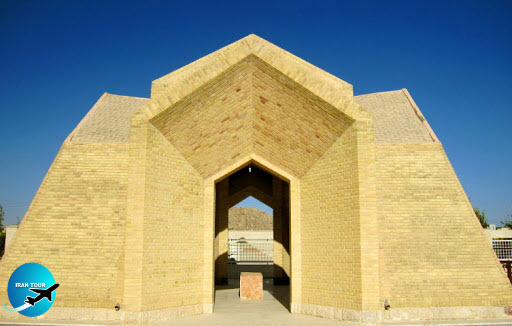
- Mausoleum of Ahmad Neyrizi
One of the most celebrated Iranian calligraphers, Ahmad Neyrizi is highly regarded as the last great master of the Naskh script. Almost nothing is known about the artist's life, but he is credited as the copyist of 99 Korans and 77 other books. He died in 1764 and was buried in his native town. His mausoleum was built in 1976.
 |
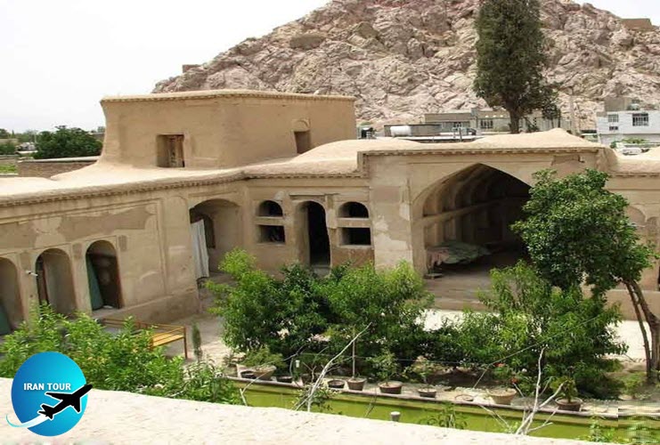
| Javid Historical House Neyriz |
-IJ
If traveling from Neyriz to Darab, the curious visitor can take a walk to the Ij sanctuary. The pathway goes through groves of wild pomegranates and is particularly pleasant in autumn. According to medieval history books, the fort of lj, located high up on the mountain slopes about 25 km east of Estahban, was the seat of the Shabankareh governors, who ruled over Fars during the 12th century. However, it seems that long before this time, the site enjoyed an important position, in sharp contrast with its derelict condition of today. Now the fort is in ruins, but the shrine, which consists of a grotto carved into the cliff, together with a small Chahar-Tagt, are in a perfect state of preservation. Several | large, very deep wells were hewn out of the mountain all along the way from the sanctuary to the fort; archaeologists maintain that their number was seven. Today most of the water is used for cultivation purposes, but in the past, it entered water channels that had been cut in the mountainside and which flowed into the water storehouses inside the fort. At one point, the water was collected in a pool covered over by a trapezoidal, domed building. This structure, still extant, has a door on the south side, while its other three walls are pierced by windows. Inside, it has a stone pool filled with two canals; the pool may have been used for some sort of religious practices having to do with water. Opposite the building, a deep arch is hewn out in the cliff; this may have been added at the same time as the domed structure. A stone staircase of six steps leads to the rectangular platform and a cave, which is elevated one step more. At a later date, perhaps during the Ilkhanid period, the grotto was turned into a mosque. The site was enclosed by a wall made of huge stones placed on top of each other; parts of the wall remain today.
- Details
- Category: Museums of Shiraz