Copyright 2020 - 2021 irantour.tours all right reserved
Designed by Behsazanhost
Kashan County at a glance
Kashan County at a glance
With a population of over 302,000 people and an area of 7.955 sq. km is located north of Esfahan. east of Markazi and south of Qom Provinces. It consists of four districts Markazi, Qamsar, Niasar, and Barzuk, six cities Kashan, Qamsar, Niasar, Meshkat, Josheghan, Kamo, and Barzuk plus nine boroughs. The only river running through this county is Qamsar River, originating from the Karkas mountains to the northwestern side of Kashan facing south. Mount Karkas itself is the most important summit at 3,950 m above sea level.
 |
Although one part of this county is mountainous and the other is desert, it nonetheless produces a variety of fruits along with grains and cereals. These agricultural lands grow wheat, barley, cotton, tomatoes, summer crops, vegetables, apples, and grapes. Further, red roses grown in Qamsar, allow famous perfumes and rose water to be produced. Watermelon, melon, and pomegranate thrive around Fin and Ravand.
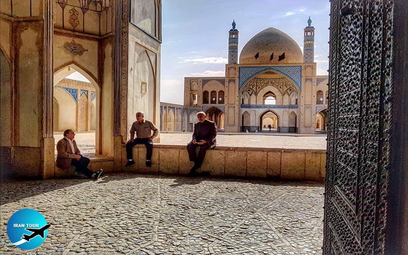
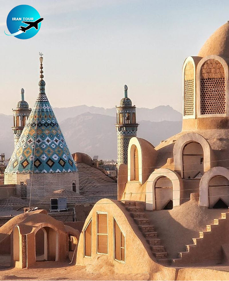
Kashan City is a hidden pearl of the central desert margin. Backed by the Karkas mountains, it covers an area of about 21 sq. km and is located at 51°27' longitude and 33°59' latitude with an average altitude of 950 m. From a geographical point of view, Kashan is on the northern side of Esfahan Province. It has an arid climate, being next to a desert, but it enjoys mild and desirable weather during the last hours of the day because of the wind flowing down from Karkas Mountain. According to the last census, the population of Kashan was estimated to be over 200,000.
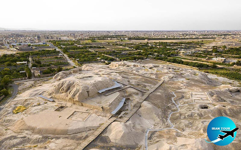 |
Kashan is as old as this ancient land with relics of one of the oldest civilizations not only of Iran but of the world, being found next to the city at Teppeh Sialk. The remnants of earthenware from this 7,000-year-old civilization are a visual treat for visitors. This city has had numerous historical monuments that have, unfortunately, been destroyed or damaged by successive earthquakes. Nevertheless, the glory and grandeur of its remaining monuments are enough to justify it being called a minor Esfahan. Sialk Teppehs is on the southwestern side of Kashan next to the Kashan-Fin road. They consist of two main hills 600 m apart. The excavations done on these teppehs by Roman Ghirshman reveal that this historical teppehs date back to the fifth millennium BCE. The objects found in Sialk compare to those found in Susa, Mosian, Gian, and Hesar Teppehs as an indication of its antiquity. In all of the history of mankind, this place is one of the oldest settlements and of the highest historical importance.
 |
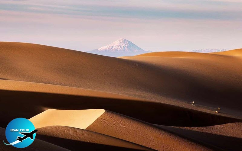 |
| A view of Damavand peak from the Maranjab desert |
It is of world significance. Excavations have been carried out in three phases, the first in 1933, the second in 1934, and the last one in 1937. These excavations lead to the identification of 17 cultural periods, of which the oldest dates back to the fifth millennium BCE. An interval of over 1,000 years passed before the next settlement continued on the same site. The more central mound has two separate gravesites with more than a hundred graves belonging to tribes new to Iran, namely the Aryans and the Medes.
 |
The Central Kavir or Great Salt Lake of Iran is the relic of a large body of water. As the water receded, some small fertile plains resulted, and on these people settled. The oldest objects found to date from that period are found at the northern site. The first homes built were made of woven reeds sealed with mud, as the earliest peoples hunted and started to cultivate crops and domesticate animals. The excavation of stone tools provides evidence of these activities. In the next period, the earliest mud houses appeared, shortly followed by the invention of the potter's wheel allowing pitchers and other items to be produced. People eventually traveled and life was enhanced by early trade. However, all of a sudden, the northern mound, for reasons unknown, was abandoned. The discovery of a layer of ash over the excavated strata is an indication of a fire, perhaps caused by invading forces, as the cause of the cessation of activities at this site. The story continues at the southern site.
 |
Aryans settled in the central parts of the Iranian plateau and imposed their civilization on the aboriginal people. Sialk pottery nowadays is respected in many of the museums of the world and is recognized as the best example of earthenware. Metalwork, contemporary with the earthenware, made great progress and copper implements took over from the stone tools. Decorative objects such as big copper hairpins were made using agates, turquoise, lapis lazuli, jasper, and shellfish. The earliest medallions were eventually made. The invention of stone seals and their widespread use show the importance of individual ownership of property. Local trades declined and cultural and commercial exchanges with other tribes were resumed. The existence of horse and carriage prints on the pottery of the southern cemetery, as well as iron swords and Harnesses, prove that Sialk had been assaulted by many invaders. In the last period of the Sialk civilization, we can see the evidence of a tribe called the Medes, who over 100 years later became the founders of a great epoch in the history of Iran and indeed the history of mankind. These Medes forcefully entered Sialk and abolished the old customs and habits. Medes continued to live there for two centuries and were the final occupants of Sialk. It is worth mentioning that late excavations have raised the question that this place may have been a Ziggurat temple complex, especially the central mound, but this has not yet been proved. The skeletons of a man and a child left there from the fourth millennium BCE testify that they had been killed due to the collapse of a ceiling.
- Details
- Category: KASHAN TOURISM