Copyright 2020 - 2021 irantour.tours all right reserved
Designed by Behsazanhost
The Untraveled, Unknown wonders of Chabahar
The Untraveled, Unknown wonders of Chabahar
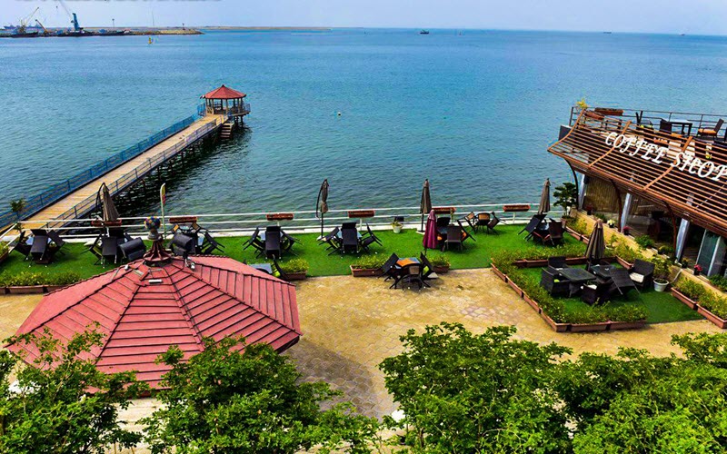
Chabahar, meaning four springs is a city in and capital of ChahBahar County, Sistan, and Baluchestan Province, Iran. Chabahar is a free port (Free Trade Zone) on the coast of the Gulf of Oman. Chabahar is situated on the Makran Coast of Sistan and the Baluchestan Province of Iran and is officially designated as a Free Trade and Industrial Zone by Iran's government. Due to its free trade zone status, the city has increased in significance in international trade. The overwhelming majority of the city's inhabitants are ethnic Baluch who speak the Baluchi language.
 |
- Climate
The county of Chabahar has hot, humid weather in the summer and warm weather in the winter, giving it a hot desert climate. The western winds in the winter bring about scattered rainfalls in this region. The summer monsoon winds from the Indian subcontinent make Chabahar the coolest southern port in the summer and the warmest part of Iran in the winter. It has an average maximum temperature of 34 and an average minimum temperature of 21.5. It has the same latitude as Miami in Florida, USA, and temperatures are very similar to those in Miami.
 |
-Bahu Kalat Plain
Bahu Kalat Plain, home to thousands of hectares of banana and watermelon farms, is very attractive for domestic and foreign tourists. Portuguese Castle, TIS Tourism Village, and Lipar Wetland as well as several shopping centers, established in the port, create an unforgettable memory for visitors to the port city.
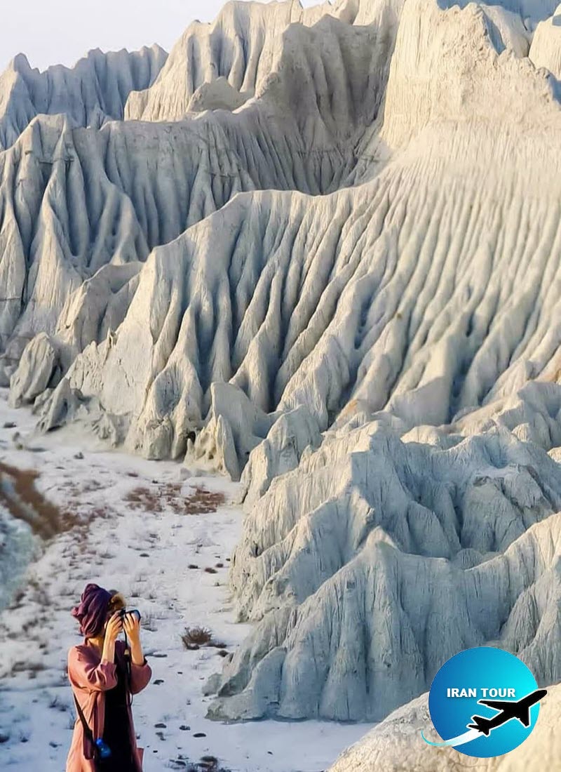 |
| Martian Mountains |
-The rocky coast of Chabahar
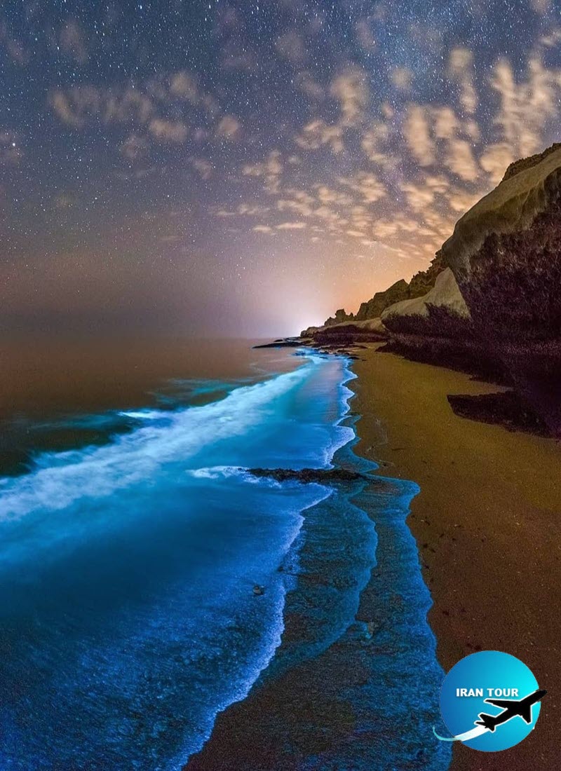
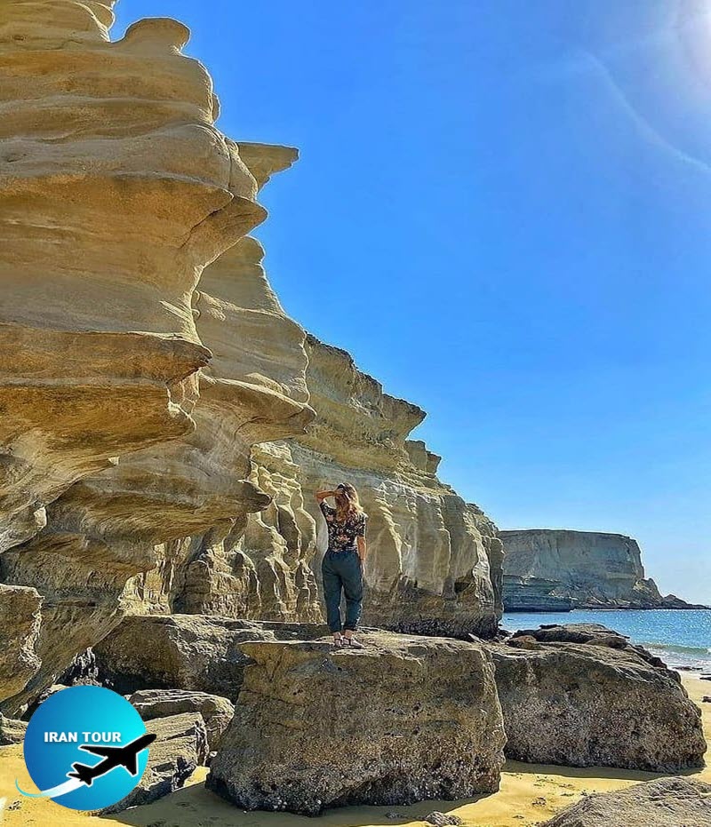
Coasts along the Oman Sea, particularly in Chabahar, are rocky. Iran's most beautiful rocky coasts are in Sistan and Baluchestan Province. Whales can often be seen frolicking off these coasts.
-Banmasity Caves
In the Shahbazband Mountains, about 25 m above ground level, there are two man-made caves and one natural one. The trio is called Banmasity Caves by locals. In the local language, the ban means a pious person and masity is a place of worship. Inside the small natural cave, there is a cubic grave whose dome is 40 cm in height. On three sides of the dome, there are inscriptions and signs in red and purple which are similar to Indian writing. Seven steps away, there is a second cave made of stucco and stone. The third cave is 50 m away. These caves seem to have served as either a shelter or a place of worship. At the entrance to all three caves, there is a platform that seems to have been used for religious rituals.
 |
-Historical Port Village of Tis
This village is 5 kilometers north of Chabahar City and is situated in the opening mouth of Chabahar Gulf. Moghadassi, the historian of the fourth century of Hijra (Islamic Calendar) has written that Tis or Tiz is a small port, but very habitable and highly flourishing. This village is located in the direction of the south shores of Iran. Tis used to be considered as the commercial center for sugar and wheat of both Makran and Sistan provinces in those days, Martian Mounts Mars or Martian Mounts are a type of badlands stretched out parallel to the sea, starting from Kachoo village up to the proximity of Gwater. Martian Mounts are extremely beautiful and are considered to be symbols of the unique geo-morphological phenomena of Chabahar.
- Seyyed Gholam Rasoul's Tomb
According to Muslim accounts, Seyyed Gholam Rasoul, originally known as Seyyedena Mohammad, was an Indian Muslim. On a visit to Chabahar, he decided to marry a local girl, but on his wedding night, he fell ill. In his will, he asked others to refrain from mourning for him and instead celebrate for ten nights to secure blessings for his soul. Every year on the 15th of the 11th month of the lunar calendar, a 10-day celebration is held in his memory at his tomb, 5 km to the northwest of Chabahar. During the ceremony, elderly women enter the tomb to say prayers for others and ask God to heal the sick while men stay outside and play music. The tomb has white walls with Indian-style architecture. The exterior of the structure is graced with paintings and religious phrases. This structure was built in the Seljuq era, and its murals were painted later during the Safavid era. The tomb dates back to the 11th century AD.
The road passing through Lipar Lake This is such an amazing route because the road passes through the lake and on one side of the road the water is salty and on the other side, there's sweet water which is used for agriculture. More than that, there is a vast and untouched sandy seacoast on the right and the strange Mars Mountains on the left.
 |
-Portuguese Castle
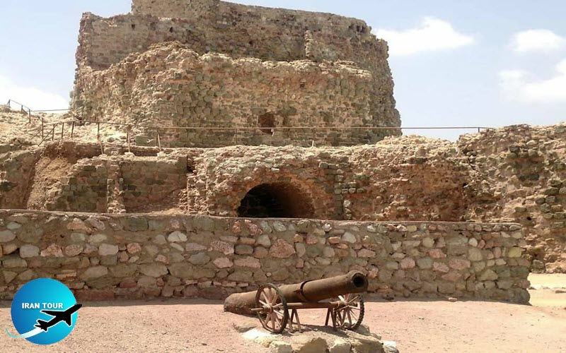
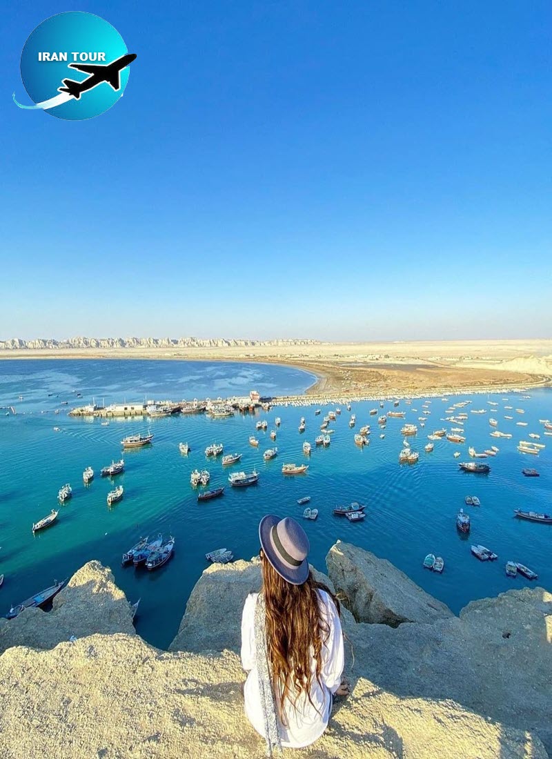
The so-called Portuguese Castle is located on top of a hill in the village of Tis which was an important Iranian seaport during the Achaemenid Empire. The castle five km away from Chabahar was built during the Safavid era. As the Portuguese started to expand their naval fleet in the 16th century, they used the castle as a base to extend their influence in Iran and other Persian Gulf countries. The area where the castle is built dates back to the pre-Islamic era. The castle has been registered on the list of Iran's national heritage sites.
 |
-Lipar Lagoon
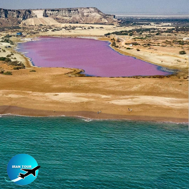
The pink wetland of Lipar is located just 200 meters from the northern edge of the Oman Sea and south of a namesake village in Chabahar, in Sistan and Baluchestan Province. The wetland is one of the alluring natural attractions of the area. What stands out about the wetland, which sits on the edge of Lipar's seasonal lagoon 20 kilometers to the east of Chabahar, is its water which looks pink. This body of water which is 10 hectares in area, accounts for 90 percent of herbal planktons in the region and is home to a large number of, flora and fauna species.
 |
-Mud Volcano
In the northwest of Chabahar, 20 km away from Kahir Village, in a vast plain, there is a mud volcano. Mud volcanoes are remarkable geo-tourist attractions. There are only a handful of mud volcanoes – formations created by geo-exuded slurries and gases - across the world. Sounds similar to gunshots can be frequently heard when such volcanoes are active. The mud volcano in Chabahar is 20 m in height and its crater is 12 m in diameter. Over several years of activity, the flow of mud has formed a hill around the volcano where no plant can grow.
-Telegraph House
Telegraph House is the oldest modern building in Chabahar which was built by the British in 1864, at the end of the Qajar era, to promote sailing and trade and connect India, Jask (a city in Hormozgan Province), and Bandar Abbas. The beautiful structure with sloping slate shutters and arches has been registered as a national monument.
 |
-Beaches
Chabahar Beaches own one of the most scenic coastal areas in Iran. Chabahar Beaches are suitable for many water sports and activities including swimming, diving, snorkeling, canoeing, water skiing, surfing among others. Mangrove forest This forest is located alongside the Gwater Gulf which has made suitable residence for valuable species of seabirds such as flamingo, eagle, heron, etc.
-Gwater Castle
This castle is located in the farthest South East of Iran, in the direction of the coastal road of Gwater-Chabahar on the top of the hill. There are an ancient graveyard and a well in this area. The discovered earthenwares in this place belong to the third millennium B.C.
- Details
- Category: Where to go in IRAN